We were the first health system in the nation to develop what's called a low-level IFR (instrument flight rules) en-route structure, gaining FAA approval in 2013.
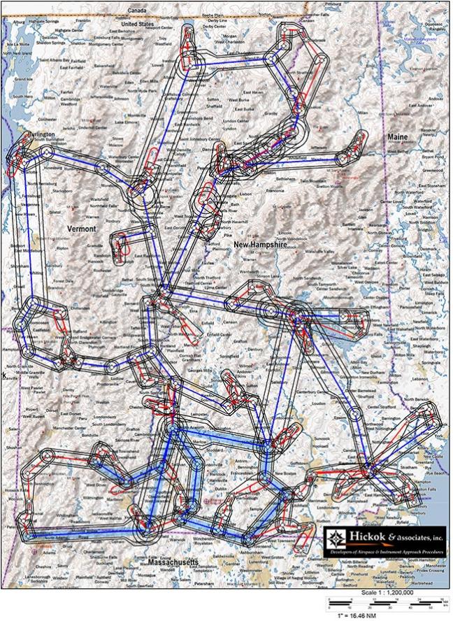
We worked with Metro Aviation and an engineering firm to meticulously map the entire region using GPS technology and created a series of routes for the pilots to follow—pre-designated flight patterns that can be navigated using instruments only.
"This allows us to fly in less than ideal weather conditions to the 30 most frequently visited hospitals in New Hampshire and Vermont that rely on us for critical care in emergencies," explains Kyle Madigan, director of DHART. Over the past year, DHART has done nearly 100 more transports thanks to the new system
Below are the areas that DHART helicopters serve.